Picture: 3D mapping of rainforests
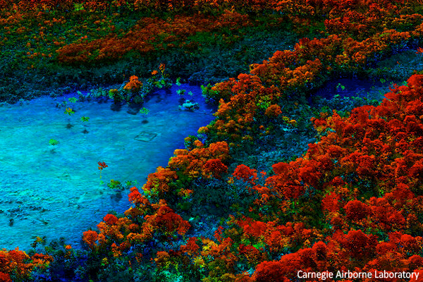
High-resolution example of deforestation and degradation in the Peruvian Amazon. Image courtesy of the Carnegie Airborne Laboratory.
In 2009, researchers with the Carnegie Institution, World Wildlife Fund, Amazon Conservation Association, and the Ministry of Environment, Peru used satellite images and airborne Light Detection and Ranging (LiDAR), together with field plots, to map aboveground carbon stocks and emissions at 0.1-ha resolution over 4.3 million ha of the Peruvian Amazon. To measure forest deforestation, degradation, and regrowth, the researchers collected 27 LiDAR survey areas covering a total of 514,317 ha throughout the 4.3 million ha region, at a spatial resolution of less than one meter (3 feet).
Results of the research were published in September 2010 in the Proceedings of the National Academy of Sciences. The mongabay write-up can be found at Peru’s rainforest highway triggers surge in deforestation, according to new 3D forest mapping.
More about the exercise, which is being duplicated in other forests around the world, is available at the Carnegie Airborne Laboratory’s new web site: cao.ciw.edu.