Scientists propose using lasers to map rainforests
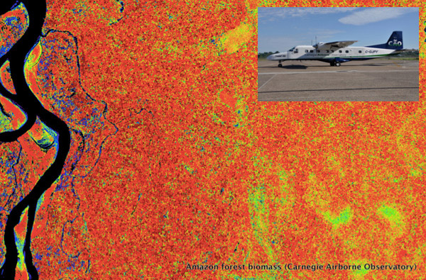
Forest map in the Peruvian Amazon developed from the Carnegie Airborne Observatory, an airplane-based platform that uses advanced LiDAR to measure forest carbon values and other properties. Photo courtesy of the Carnegie Institution for Science
- A new Carbon Balance and Management paper argues that mapping the world’s tropical forests with a fleet of airplanes outfitted with advanced lasers, known as LiDAR, could rapidly and accurately assess global forest carbon stocks for $250 million, or less than the cost of a typical Earth observation satellite mission.
- The paper says the system could be used to provide a baseline for REDD+, a program that aims to compensate tropical countries for reducing carbon emissions from deforestation and forest degradation.
- LiDAR would be faster and cheaper than current ground-based approaches and more accurate than satellite-based systems.
More: World’s rainforests could be mapped in 3D at high resolution by 2020 for under $250M