The Initiative for Public Policy Analysis is a Nigeria-based palm oil lobby group
The Initiative for Public Policy Analysis (IPPA), which describes itself as a think-tank or public policy group, has launched a campaign targeting the World Bank on its palm oil lending policy.
Picture: a peaceful place in Arizona
Deer Creek, Arizona.

Photos from Halmahera, one of the world’s strangest and least recognized biodiversity hotspots
The following pictures were taken by Dmitry Telnov during visits to Halmahera, largest island in the Maluku Islands.
Picture: Iceland’s spectacular Gullfoss waterfall
Gullfoss or “Golden Waterfall”
Wikileaks: The EU and Germany Are Failing to Lead on Climate Change
Perhaps, prior to the Wikileaks scandal, small island nations which stand to be deluged by rising sea levels might have looked to the
European Union and, specifically, Germany to provide leadership on climate change. Recent disclosures, however, have probably dashed any such hopes.
Far from looking out for the interests of vulnerable countries imperiled by global warming, the European Union has conspired with the United States to
limit the scope of climate change reform in international negotiations.
Picture: a glorious tropical sunset
Sunset in Kauai, November 2010. Photo by Rhett A. Butler
Leaping lemur (picture & video)
Verreaux’s sifaka is a lemur which can be spotted in Madagascar’s deciduous forest habitats including Andohahela, Berenty, Beza-Mahafaly, Isalo, and Kirindy.
Wikileaks: From South Atlantic to South Pacific, It’s Open Season on Environmentalists
Though Wikileaks documents have illuminated the underhanded foreign policy shenanigans of governments world-wide, the cables also demonstrate that many states are intent on halting meaningful progress on the environment. Previously, I discussed how the U.S., as well as other emerging powers such as Brazil, sought to derail international climate change negotiations. In light of recent cables, however, it’s clear that these revelations merely represent the beginning of larger disclosures. From the South Atlantic to the South Pacific, governments are paranoid about environmentalists and worry that activists might get in the way of inhumane or polluting industries.
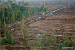
Picture: 3D mapping of rainforests
In 2009, researchers with the Carnegie Institution, World Wildlife Fund, Amazon Conservation Association, and the Ministry of Environment, Peru used satellite images and airborne Light Detection and Ranging (LiDAR), together with field plots, to map aboveground carbon stocks and emissions at 0.1-ha resolution over 4.3 million ha of the Peruvian Amazon. To measure forest deforestation, degradation, and regrowth, the researchers collected 27 LiDAR survey areas covering a total of 514,317 ha were collected throughout the 4.3 million ha region, at a spatial resolution of less than one meter.
Forest on New Year’s morning
Huddart County Park, Woodside, CA.